Home AVI Real Estate Construction

Category: Engineering surveys

What Is a Cadastral Survey and Why Is It Important?

A cadastral survey is a detailed examination and mapping of land parcels, which includes the determination of boundaries, dimensions, and the ownership of land. This type of survey is essential for establishing legal ownership and is a critical component of land management and urban planning. In Australia, where land ownership and use are governed by a complex system of laws and regulations, understanding the significance of cadastral surveys is vital for property owners, developers, and government authorities alike.

The Fundamentals of Cadastral Surveys

A cadastral survey is not merely a technical exercise; it is a legal requirement that ensures clarity and certainty in land ownership. The survey involves the precise measurement of land boundaries and the creation of a cadastral map that outlines these boundaries. This map serves as a legal document, providing evidence of ownership and facilitating the transfer of property rights.

Key Components of a Cadastral Survey

Several key components make up a cadastral survey. Firstly, the surveyor must establish the existing boundaries of the property, which may involve referencing historical records, previous surveys, and physical markers on the land. Secondly, the surveyor will create a detailed map that illustrates the dimensions and layout of the property, including any easements or encroachments that may affect ownership rights.

Additionally, cadastral surveys often involve the identification of land use, zoning regulations, and any restrictions that may apply to the property. This comprehensive approach ensures that all aspects of land ownership are accounted for, providing a clear understanding of the rights and responsibilities associated with the land. The meticulous nature of this process is crucial, as even minor discrepancies in boundary definitions can lead to significant legal disputes, affecting not only current owners but also future generations.

The Role of Technology in Cadastral Surveys

Modern technology has revolutionised the field of cadastral surveying. The use of Geographic Information Systems (GIS), Global Positioning Systems (GPS), and advanced surveying equipment has significantly improved the accuracy and efficiency of surveys. These tools allow surveyors to collect data with precision, create detailed maps, and analyse land use patterns more effectively than ever before.

Furthermore, the integration of technology enables better communication and collaboration among stakeholders, including landowners, government agencies, and urban planners. This collaborative approach is essential for effective land management and ensures that all parties have access to accurate and up-to-date information. For instance, GIS technology not only aids in the visualisation of land parcels but also allows for the layering of various data types, such as environmental factors and infrastructure developments, providing a holistic view of land use. As cities continue to grow and evolve, the ability to adapt and respond to changing land dynamics through technological advancements becomes increasingly vital for sustainable development.

The Importance of Cadastral Surveys

Cadastral surveys play a crucial role in various aspects of land management, property development, and urban planning. Their importance extends beyond the mere establishment of boundaries; they are foundational to the legal and economic frameworks that govern land use in Australia.

Legal Certainty and Property Rights

One of the primary reasons for conducting a cadastral survey is to provide legal certainty regarding property rights. In Australia, land ownership is a complex issue, with various laws and regulations governing the use and transfer of land. A cadastral survey provides a clear and legally recognised definition of property boundaries, reducing the potential for disputes between neighbours and ensuring that property rights are upheld.

Without a cadastral survey, property owners may find themselves in ambiguous situations where the boundaries of their land are unclear. This uncertainty can lead to conflicts, legal disputes, and even financial losses. Therefore, having a cadastral survey conducted is essential for anyone looking to buy, sell, or develop land.

cadastral survey

Facilitating Urban Planning and Development

Cadastral surveys are also vital for urban planning and development. As cities grow and evolve, accurate land information is necessary for making informed decisions about land use, zoning, and infrastructure development. Planners rely on cadastral surveys to understand the existing land use patterns and to identify potential areas for development or conservation.

Moreover, cadastral surveys provide essential data for assessing the impact of new developments on the surrounding environment and community. This information is crucial for ensuring that urban growth is sustainable and that the needs of the community are met.

Cadastral Surveys and Property Transactions

In the context of property transactions, cadastral surveys are indispensable. They serve as a critical part of the due diligence process for buyers and sellers, ensuring that all parties have a clear understanding of the property being transferred. This clarity is essential for securing financing, obtaining permits, and finalising sales agreements.

Enhancing Market Confidence

The presence of a cadastral survey can enhance market confidence among potential buyers. When a property is accompanied by a recent and accurate cadastral survey, it signals to buyers that the seller is transparent about the property’s boundaries and any potential issues. This transparency can lead to quicker sales and potentially higher property values.

Conversely, properties without a cadastral survey may face challenges in the market. Buyers may be hesitant to invest in a property with unclear boundaries or unresolved disputes, leading to prolonged sales processes and reduced market value.

Resolving Boundary Disputes

Boundary disputes are a common issue in real estate, and cadastral surveys play a crucial role in resolving these conflicts. When disputes arise, a cadastral survey provides the necessary evidence to clarify property boundaries and ownership rights. This can prevent costly legal battles and facilitate amicable resolutions between parties.

In some cases, a cadastral survey may reveal encroachments or easements that were previously unknown to the property owner. By identifying these issues early on, property owners can take appropriate action to address them, ensuring that their rights are protected.

The Process of Conducting a Cadastral Survey

Conducting a cadastral survey involves several steps, each of which is essential for ensuring accuracy and legal compliance. Understanding this process can help property owners appreciate the importance of engaging qualified professionals for their surveying needs.

Engaging a Qualified Surveyor

The first step in the cadastral survey process is to engage a qualified surveyor. In Australia, surveyors must be registered and possess the necessary qualifications to conduct cadastral surveys. It is essential to choose a surveyor with experience in the local area, as they will be familiar with the specific regulations and requirements that apply.

Once a surveyor is engaged, they will conduct an initial assessment of the property, reviewing existing documentation and historical records to gather information about the land. This preliminary work is critical for understanding the context of the survey and identifying any potential issues that may need to be addressed.

Field Survey and Data Collection

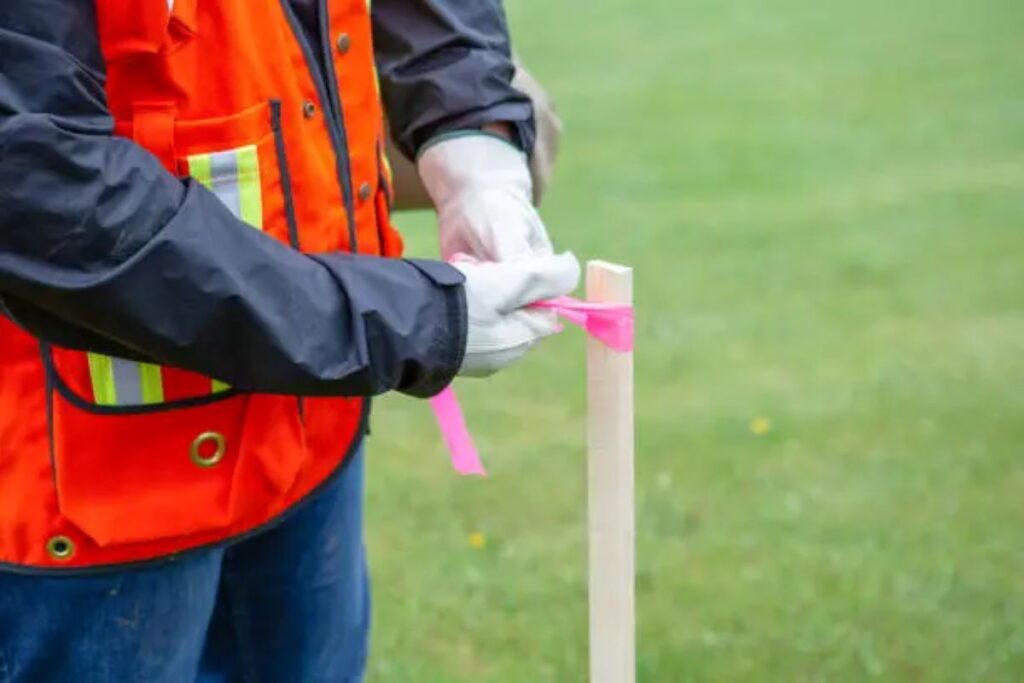
Following the initial assessment, the surveyor will conduct a field survey to measure the property boundaries and gather data. This process typically involves the use of advanced surveying equipment, such as total stations and GPS devices, to ensure accuracy. The surveyor will also identify any physical markers, such as fences or trees, that may indicate the property boundaries.

Once the fieldwork is complete, the surveyor will compile the data and create a cadastral map that outlines the property boundaries, dimensions, and any relevant features. This map serves as the foundation for the final report and is a critical component of the legal documentation associated with the property.

cadastral survey

Conclusion: The Value of Cadastral Surveys

In summary, cadastral surveys are an essential aspect of land management and property ownership in Australia. They provide legal certainty, facilitate urban planning, and enhance market confidence, making them invaluable for property owners, developers, and government authorities alike. By understanding the importance of cadastral surveys and engaging qualified professionals, stakeholders can ensure that their land transactions and developments are based on accurate and reliable information.

As urban areas continue to grow and evolve, the role of cadastral surveys will only become more critical. By investing in these surveys, property owners can protect their rights, resolve disputes, and contribute to sustainable land use practices that benefit the entire community.

More to Read : Engineering Surveys vs Land Surveys: Key Differences Explained

Engineering Surveys vs Land Surveys: Key Differences Explained

In the realm of surveying, two primary types emerge as essential for various projects: engineering surveys and land surveys. While both serve crucial roles in construction, urban planning, and development, they differ significantly in purpose, methodology, and outcomes. Understanding these distinctions is vital for professionals in the field and stakeholders involved in projects that require precise measurements and data.

Defining Engineering Surveys

Engineering surveys are specialised surveys that focus on the design and construction phases of engineering projects. They provide the necessary data to ensure that structures are built accurately according to design specifications and regulatory requirements. These surveys often involve detailed measurements and analyses that inform the engineering process.

Purpose and Applications

The primary purpose of engineering surveys is to support the planning and execution of construction projects. This includes roadways, bridges, buildings, and other infrastructure. Engineering surveys help in determining the optimal placement of structures, assessing potential environmental impacts, and ensuring compliance with local regulations.

Applications of engineering surveys can be seen in various fields, including civil engineering, environmental engineering, and geotechnical engineering. For instance, when constructing a new highway, an engineering survey will assess the topography, soil conditions, and existing utilities to inform the design and construction processes. Furthermore, engineering surveys play a critical role in urban development, where the integration of new structures into existing environments requires meticulous planning and analysis to avoid disruption and ensure sustainability.

Methods and Techniques

Engineering surveys employ a range of advanced techniques and technologies to gather accurate data. These may include total stations, GPS (Global Positioning System), and laser scanning. Each method has its advantages, depending on the project’s specific requirements.

For example, laser scanning can capture detailed three-dimensional representations of a site, which is invaluable for complex projects. Conversely, GPS technology is often used for larger areas where precise positioning is necessary, such as in the alignment of roads or pipelines. In addition to these methods, traditional surveying techniques, such as triangulation and levelling, are still employed, particularly in projects where modern technology may not be feasible or cost-effective. The combination of these various methods ensures that engineers have the most accurate and comprehensive data available, allowing for informed decision-making throughout the lifecycle of a project.

Understanding Land Surveys

Land surveys, on the other hand, are primarily concerned with the measurement and mapping of land parcels. They establish property boundaries, identify land features, and provide essential data for land ownership and usage rights. Land surveys are fundamental to real estate transactions, land development, and legal disputes.

Purpose and Applications

The main purpose of land surveys is to delineate property boundaries and provide accurate information about land characteristics. This is crucial for property owners, developers, and legal professionals. Land surveys are often required when buying or selling property, subdividing land, or resolving boundary disputes.

Applications of land surveys extend beyond real estate. They are also essential in urban planning, where accurate land data informs zoning regulations and development plans. Additionally, land surveys can assist in environmental assessments, helping to identify land use changes and their potential impacts. For example, in the context of climate change, surveys can play a pivotal role in understanding how land use patterns evolve over time, allowing for better management of natural resources and conservation efforts. Furthermore, land surveys are increasingly being used in infrastructure projects, such as the construction of roads, bridges, and public utilities, ensuring that these developments are executed within legal boundaries and with minimal disruption to the surrounding environment.

Engineering surveys

Methods and Techniques

Land surveys typically utilise traditional surveying methods, including the use of theodolites, levels, and measuring tapes. However, modern technology has also influenced land surveying practices. GPS and GIS (Geographic Information Systems) are increasingly employed to enhance accuracy and efficiency.

For instance, GIS allows surveyors to create detailed maps that integrate various data layers, such as topography, land use, and infrastructure. This comprehensive approach aids in better decision-making and planning for land development projects. Moreover, the advent of drones in surveying has revolutionised the field, enabling surveyors to capture aerial imagery and gather data over large areas quickly and accurately. This not only speeds up the surveying process but also provides a bird’s-eye view that can reveal features and details that might be missed from the ground. As technology continues to evolve, the integration of artificial intelligence and machine learning into surveying practices is anticipated to further enhance the precision and efficiency of land surveys, paving the way for innovative solutions in land management and urban development.

Key Differences Between Engineering Surveys and Land Surveys

While engineering surveys and land surveys share some similarities, their fundamental differences lie in their objectives, methodologies, and applications. Understanding these distinctions can help stakeholders choose the appropriate type of survey for their specific needs.

Objectives and Focus

The primary focus of engineering surveys is to support the design and construction of engineering projects. They provide critical data that informs the technical aspects of a project, such as structural integrity and environmental considerations. In contrast, land surveys are centred around property boundaries and land characteristics, serving legal and ownership purposes.

This difference in focus means that engineering surveys often require a higher level of detail and precision, particularly in relation to topographical features and subsurface conditions. Land surveys, while still precise, may not delve into the same level of technical detail as engineering surveys.

Data Collection and Analysis

Data collection methods also differ significantly between the two types of surveys. Engineering surveys often employ advanced technologies, such as 3D laser scanning and GPS, to gather detailed information about a site. This data is then analysed to inform engineering decisions and design processes.

In contrast, land surveys rely more on traditional measurement techniques, although modern technologies are becoming more prevalent. The data collected in land surveys is typically used for mapping and boundary determination rather than detailed engineering analysis.

Regulatory and Legal Considerations

Regulatory requirements can vary between engineering and land surveys. Engineering surveys may need to comply with specific engineering standards and regulations, depending on the nature of the project. This could involve adherence to safety standards, environmental regulations, and local building codes.

Land surveys, on the other hand, are often governed by property laws and regulations. Surveyors must ensure that their work complies with legal standards for boundary determination and land use. This legal aspect is crucial, as inaccuracies in land surveys can lead to disputes and legal challenges.

Choosing the Right Type of Survey

Determining whether to conduct an engineering survey or a land survey depends on the specific requirements of the project. Stakeholders must consider the goals of the survey, the type of data needed, and the intended use of the information gathered.

Project Requirements

For projects that involve construction or engineering design, an engineering survey is typically necessary. This type of survey provides the detailed data required for planning and executing complex projects. On the other hand, for land transactions, boundary disputes, or land development planning, a land survey is essential.

Understanding the specific requirements of the project will guide stakeholders in selecting the appropriate survey type. Consulting with surveying professionals can also provide valuable insights into the best approach for achieving project goals.

Engineering surveys

Consultation with Surveying Professionals

Engaging with experienced surveying professionals is crucial when navigating the complexities of engineering and land surveys. These experts can provide guidance on the most suitable survey type based on the project’s scope and objectives.

Additionally, surveying professionals can help ensure compliance with relevant regulations and standards, minimising the risk of errors and legal complications. Their expertise can also enhance the accuracy and reliability of the data collected, ultimately contributing to the success of the project.

Conclusion

In summary, engineering surveys and land surveys serve distinct purposes within the field of surveying. Engineering surveys focus on the technical aspects of construction and design, while land surveys are centred around property boundaries and land characteristics. Understanding the key differences between these two types of surveys is essential for stakeholders involved in construction, real estate, and land development.

By recognising the unique objectives, methodologies, and applications of engineering and land surveys, professionals can make informed decisions that enhance project outcomes. Whether embarking on a new construction project or navigating a real estate transaction, the right type of survey is crucial for success.

Ultimately, the collaboration between stakeholders and surveying professionals ensures that projects are executed with precision and compliance, paving the way for successful developments that meet both regulatory standards and community needs.

Related : What Is a Cadastral Survey and Why Is It Important?