Whether a Sydney property buyers agent is “better” than buying solo depends on what the buyer values most: time, certainty, access, and risk reduction. For many, the real comparison is not agent fees versus no fees, but a guided process versus learning the market while spending in it.
Is a Sydney property buyers agent actually worth it?
A Sydney property buyers agent can be worth it when the buyer needs speed, clarity, and negotiating leverage. They typically add value by narrowing options quickly, validating pricing, and handling strategy under pressure.
The strongest “worth it” cases are time poor professionals, interstate or overseas buyers, and buyers who have lost multiple properties due to underquoting, slow decisions, or weak negotiation.
What does a buyers agent do that a solo buyer usually cannot?
A buyers agent can provide structured shortlisting, due diligence coordination, and negotiation led by someone who buys property repeatedly. Solo buyers can do these tasks, but they often do them for the first time with higher stress and more mistakes.
They may also access off market or pre market opportunities through networks, though access varies by agent and suburb. The practical advantage is not “secret listings,” but earlier awareness and faster action.
Does a buyers agent help avoid overpaying in Sydney?
They can, mainly through pricing discipline and evidence based comparables. A good agent pressure tests the asking range, the likely competition, and the property’s weaknesses before the buyer emotionally commits.
That said, no one can guarantee a “below market” outcome in Sydney. The more realistic benefit is avoiding a bad overpay caused by fear, urgency, or underestimating what it takes to win.
Is negotiating really that different with professional representation?
Yes, because negotiation is partly about information, timing, and credibility. When an experienced agent communicates decisively, it can reduce back and forth and keep the buyer from revealing their hand.
Solo buyers often negotiate emotionally and inconsistently. They may raise offers too quickly, ask the wrong questions, or miss signals that the vendor’s expectations are unrealistic.
Do buyers agents get better access to off market deals?
Sometimes, but it should not be assumed. Many “off market” properties are simply quiet campaigns where the agent tests pricing before advertising, and those opportunities may still be competitive.
A buyers agent is most helpful when they can identify the right stock early and move fast. Their real edge is process and network, not a guaranteed pipeline of bargains.
Can a buyers agent reduce the risk of buying the wrong property?
They can reduce common risks by enforcing criteria and checking fundamentals. That includes street quality, building issues, strata red flags, layout compromises, resale appeal, and rental demand if relevant.
Solo buyers often focus on features and ignore downside. A buyers agent should act as a circuit breaker, ensuring the property still makes sense after the excitement wears off.
What are the main downsides of using a Sydney property buyers agent?
The obvious downside is cost, usually a fixed fee, a percentage, or a mix. For buyers with a very clear target and ample time, that fee may not produce a meaningful return.
There is also quality variance. A poor agent can rush decisions, push unsuitable properties, or add little beyond what the buyer could do with solid research and patience.
How can they tell if a buyers agent is good or just marketing?
A good agent is transparent about process, limitations, and how they source deals. They should explain how they assess value, how they negotiate, and what checks they insist on before exchange.
They should also show relevant track record in similar suburbs and property types, not generic success stories. If they avoid specifics on fees, conflicts, or strategy, that is a warning sign.
When is buying solo the better option?
Buying solo can be better when the buyer has time, enjoys research, and is comfortable negotiating. It also suits buyers targeting a very narrow area where they can watch listings daily and attend every inspection.
If they already understand strata reports, building risks, and Sydney pricing patterns, they may not need paid representation. In that case, a solicitor and building inspector may be enough. Check out more about choosing between different buyers agents Eastern Suburbs.
Are first home buyers better off with an agent or solo?
It depends on their confidence and support. First home buyers often benefit from guidance because they are vulnerable to underquoting, poor property selection, and rushing into compromises.
However, if they have strong family support, a cautious approach, and a willingness to miss out rather than overpay, buying solo can work. The key is whether they can stay disciplined.
Does the fee usually pay for itself?
Sometimes, but it should be measured properly. The “pay for itself” claim can come from buying at a better price, avoiding an expensive mistake, or saving months of wasted weekends and missed opportunities.
If the buyer saves even 1 to 2 percent through sharper negotiation or avoids one major defect, the fee can look small in hindsight. But if the buyer would have bought the same property anyway, it will not.
What should they do if they are unsure?
They can start with a paid consultation or a limited scope service, if available. That lets them test the agent’s thinking on suburb choice, pricing, and strategy without committing to full representation.
If the buyer’s main gap is confidence in value, they can also invest in better comparables research and attend more auctions. If the gap is time and execution, a buyers agent is more likely to help.
So, is using a Sydney property buyers agent better than buying solo?
Using a Sydney property buyers agent is better when the buyer needs speed, negotiation strength, and protection from common mistakes. Buying solo is better when they have time, market knowledge, and the temperament to stay patient.
The deciding factor is not the market, it is the buyer. If they value certainty and expert execution, an agent can be a strong advantage. If they value control and can handle the workload, solo buying can be just as effective.
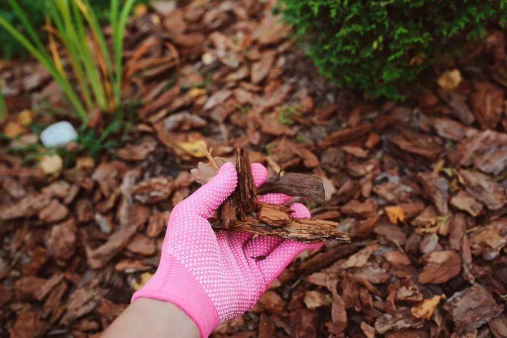
They should use wood chips instead of typical mulch when they want longer-lasting coverage, better moisture protection, and a more natural soil-building layer, especially around trees and shrubs.
What’s the real difference between wood chips and “mulch”?
wood chips are larger, chunkier pieces of wood that break down slowly. Most bagged mulch is finer, more uniform, and often shredded bark or wood that can mat together.
Because chips have more air gaps, they drain and breathe better, while many shredded mulches can form a tighter layer that sheds water if applied too thickly.
When should they choose wood chips around trees and shrubs?
They should choose wood chips when planting or maintaining trees and shrubs, because chips mimic the forest floor and protect roots well. A coarse layer helps keep soil temperatures stable and reduces drought stress.
Wood chips also resist blowing away and typically need topping up less often than fine mulch, which can thin out or fade faster.
When are wood chips better for moisture control and heat protection?
They are a strong choice when the goal is to reduce watering and buffer soil from summer heat. A thick chip layer slows evaporation and keeps the root zone cooler.
This matters most in exposed beds, new plantings, and sandy soils where water drains quickly. Chips help those areas stay evenly moist without making the surface soggy.
When do wood chips beat mulch for weed suppression?
They are often better when weeds are persistent, because thicker, coarser layers block light effectively and are harder for weeds to push through. Chips also stay in place, so gaps do not open as quickly.
For best results, they should remove existing weeds first, then apply chips deeply enough to limit germination rather than relying on a thin “tidy” layer.
When should they avoid wood chips in flower beds?
They should avoid wood chips when a bed is frequently replanted, divided, or redesigned, because chips get in the way during digging. The larger pieces also look rougher next to small annuals and can make precise edging harder.
In those cases, a finer mulch can be easier to spread, rake back, and refresh without dragging chunks into planting holes.
When are wood chips a smarter pick for pathways and informal areas?
They are a great fit for garden paths, play areas, and informal zones where comfort and drainage matter more than a polished look. Chips knit together over time and create a stable walking surface.
They should still expect periodic top-ups, especially in high-traffic routes, since chips compress and migrate outward with use.
How thick should they apply wood chips, and where should they keep them back?
They should apply wood chips about 2–4 inches deep for most landscape beds. Less than that breaks weed control and moisture benefits, and much more can limit oxygen near the surface.
They should keep chips a few inches away from stems and trunks. Piling chips against bark can trap moisture and invite rot, insects, and disease, especially when it forms a mound around a tree base. Learn more about wood mulch: 6 benefits for soil health.
Do wood chips “steal nitrogen,” and should they worry?
They generally should not worry when chips stay on the surface, because nitrogen tie-up happens mainly where wood is mixed into soil. The microbial activity is strongest at the soil-chip boundary, not throughout the root zone.
If they are planting into a chipped bed, they can add compost in the planting hole or feed with a light, balanced fertilizer if growth looks pale. Most established shrubs and trees do fine without extra steps.
What’s the bottom line on using wood chips instead of mulch?
They should use wood chips instead of typical mulch when they are mulching trees, shrubs, and low-maintenance beds, or when they want long-lasting moisture control and strong weed suppression. They should skip chips when they need a refined look, frequent replanting, or a very uniform finish.
If they want one simple rule: choose wood chips for durability and soil-building, and choose finer mulch for presentation and easy bed maintenance.
FAQs (Frequently Asked Questions)
What is the difference between wood chips and typical mulch?
Wood chips are larger, chunkier pieces of wood that break down slowly, providing better air gaps for drainage and breathability. Typical mulch is finer, often shredded bark or dyed wood, which can mat together and shed water if applied too thickly.
When should I use wood chips around trees and shrubs?
Use wood chips when planting or maintaining trees and shrubs because they mimic the forest floor, protect roots well, keep soil temperatures stable, reduce drought stress, resist blowing away, and require less frequent topping up compared to fine mulch.
How do wood chips help with moisture control and heat protection?
A thick layer of wood chips slows evaporation, keeps the root zone cooler, and helps maintain even moisture levels. This is especially beneficial in exposed beds, new plantings, and sandy soils where water drains quickly.
Are wood chips effective for weed suppression?
Yes, wood chips are often better for persistent weeds because their thicker, coarser layers block light effectively and are harder for weeds to push through. They also stay in place longer, preventing gaps that allow weed growth.
When should I avoid using wood chips in flower beds?
Avoid wood chips in flower beds that are frequently replanted, divided, or redesigned because the larger pieces can interfere with digging and look rough next to small annuals. Finer mulch is easier to spread and refresh in these situations.
How thick should I apply wood chips and where should I keep them away from plants?
Apply wood chips about 2–4 inches deep to ensure weed control and moisture benefits without limiting oxygen. Keep the chips a few inches away from stems and trunks to prevent moisture trapping that can cause rot, insects, and disease.
Below are six soil-health benefits that make wood mulch worth considering in gardens, landscapes, and around trees.
How does wood mulch help soil hold moisture?
wood mulch reduces evaporation by shading the soil surface and buffering it from wind and direct sun. That means the soil stays evenly damp for longer, which helps roots grow deeper instead of chasing quick surface water.
With steadier moisture, soil microbes stay active, and plants typically experience fewer drought swings. They often find they can water less frequently, especially during hot, dry weeks.
How can wood mulch regulate soil temperature?
Wood mulch acts like insulation. It keeps soil cooler during summer heat and reduces rapid temperature drops during cold nights.
This matters because roots and beneficial microbes perform best in stable conditions. When soil temperatures swing less, plants usually show more consistent growth, and tender root tips are less likely to get stressed by heat spikes.
How does wood mulch reduce erosion and soil compaction?
Mulch softens the impact of heavy rain, so soil particles are less likely to splash, crust, or wash away. It also slows runoff, giving water more time to soak in.
Over time, they may notice less surface sealing and fewer hard, compacted spots. That creates better pore space for air and water, which supports stronger root development and healthier soil structure.
How does wood mulch feed soil life and increase organic matter?
As wood mulch breaks down, it becomes food for fungi, bacteria, and other decomposers. Their activity gradually turns mulch into organic matter that improves soil texture and nutrient-holding capacity.
In many soils, fungi play a key role in cycling nutrients and building stable aggregates. Wood-based mulches tend to support fungal networks, which can be especially helpful around trees, shrubs, and perennial beds.
How does wood mulch support better nutrient cycling?
Wood mulch does not act like a fast fertilizer, but it supports the system that makes nutrients available. As decomposers process the material, nutrients are released slowly and soil chemistry becomes more balanced over time.
They may also see fewer nutrients lost to runoff because mulch reduces water flow across the surface. In practical terms, this often means steadier plant growth and less reliance on frequent feeding.
How can wood mulch suppress weeds without harming soil?
A properly applied mulch layer blocks light, making it harder for many weed seeds to germinate. It also makes any weeds that do appear easier to pull because the soil underneath stays looser and more moist.
Unlike plastic barriers, wood mulch improves soil as it ages. They get weed pressure reduction while still allowing water infiltration and gas exchange, which protects soil biology.
What is the best way for them to apply wood mulch for soil health?
For most beds, they should aim for a 2–4 inch layer, keeping mulch a few inches away from stems and trunks to reduce rot and pest issues. Around trees, they should avoid “mulch volcanoes” and instead create a wide, flat ring.
They will usually get the best results when mulch is applied on top of existing soil, not mixed in deeply. If they want to improve soil faster, they can top up annually as the layer decomposes and thins. Learn more about wood chips: when should you use them instead of mulch?
Which wood mulch types tend to work best?
Arborist wood chips, shredded bark, and mixed hardwood chips are common choices. Coarser chips often last longer and resist matting, while very fine mulch can pack down and shed water if it becomes too dense.
If they are mulching vegetable beds, they may prefer aged wood chips or partially composted material for easier management. For trees and shrubs, fresh arborist chips are often a strong option because they break down gradually and support fungal life.
FAQs (Frequently Asked Questions)
How does wood mulch help improve soil moisture retention?
Wood mulch reduces evaporation by shading the soil surface and buffering it from wind and direct sun. This keeps the soil evenly damp for longer periods, encouraging roots to grow deeper instead of relying on quick surface water. Steadier moisture also keeps soil microbes active and allows plants to experience fewer drought swings, often reducing the need for frequent watering during hot, dry weeks.
In what ways does wood mulch regulate soil temperature?
Wood mulch acts as an insulating layer that keeps soil cooler during summer heat and reduces rapid temperature drops during cold nights. This temperature stability benefits roots and beneficial microbes, promoting consistent plant growth and protecting tender root tips from stress caused by heat spikes.
How does wood mulch contribute to reducing soil erosion and compaction?
By softening the impact of heavy rain, wood mulch prevents soil particles from splashing, crusting, or washing away. It slows runoff, allowing more water to soak into the ground. Over time, this leads to less surface sealing and fewer compacted spots, creating better pore space for air and water which supports stronger root development and healthier soil structure.
What role does wood mulch play in feeding soil life and increasing organic matter?
As wood mulch breaks down, it serves as food for fungi, bacteria, and other decomposers. Their activity gradually transforms the mulch into organic matter that improves soil texture and nutrient-holding capacity. Wood-based mulches particularly support fungal networks crucial for nutrient cycling and building stable soil aggregates around trees, shrubs, and perennial beds.
Can wood mulch aid in nutrient cycling without acting as a fast fertilizer?
Yes. While wood mulch doesn’t provide nutrients quickly like fertilizers, it supports the natural system that makes nutrients available. Decomposers slowly release nutrients as they process the material, balancing soil chemistry over time. Additionally, by reducing surface water flow, mulch minimizes nutrient loss through runoff, resulting in steadier plant growth with less need for frequent feeding.
How does wood mulch suppress weeds while benefiting the soil?
A properly applied layer of wood mulch blocks light from reaching weed seeds, making germination harder. It also keeps the soil underneath looser and moister, making any emerging weeds easier to pull out. Unlike plastic barriers, wood mulch enhances soil quality as it ages by allowing water infiltration and gas exchange, thereby protecting vital soil biology while reducing weed pressure.
What is Residential Pest Control in Sydney and Why is it Important for Homeowners?
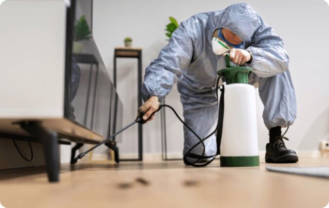
Residential Pest Control Sydney refers to professional services designed to protect homes from unwanted pests through thorough inspection, effective treatment, and long-term prevention strategies. Licensed technicians accurately identify pest issues and apply targeted solutions to eliminate infestations while safeguarding your property and household.
Sydney’s warm, humid climate creates ideal breeding conditions for a wide range of pest species. Combined with the city’s dense urban environment, pests have easy access to food sources and shelter. Without reliable residential pest control Sydney, infestations can compromise your home’s structural integrity, contaminate food supplies, and pose serious health risks to your family.
Why Home Protection Matters
Pests carry diseases and allergens that threaten household health. Cockroaches trigger asthma and allergies, whilst rodents spread harmful bacteria through their droppings. Termites silently destroy wooden structures, causing thousands of pounds in repair costs. Professional home protection addresses these threats before they escalate into costly emergencies.
Common Pests in Sydney’s Environment
Sydney homeowners regularly encounter:
Ants: Kitchen ants and Argentine ants invade pantries seeking food
Cockroaches: German, American, and Australian species thrive in humid conditions
Spiders: Funnel-webs and redbacks pose venomous threats
Rodents: Mice and rats contaminate living spaces
Other invaders: Bed bugs, fleas, silverfish, wasps, bees, termites, crickets, and moths
The region’s consistent temperatures allow many pest species to remain active year-round. This perpetual activity cycle means homeowners need vigilant, ongoing protection rather than one-off treatments. Professional services adapt to seasonal variations in pest behaviour, ensuring comprehensive defence throughout the year.
What Are the Most Common Pests Found in Sydney Homes?
Sydney homes face invasion from numerous pest species adapted to the region’s warm, humid conditions and urban landscape. The most frequently encountered pests include various ant species, multiple cockroach types, dangerous spiders, persistent rodents, and destructive termites, alongside secondary invaders like bed bugs and silverfish.
Ants: Kitchen Invaders and Garden Dwellers
Kitchen ants (also known as black house ants) represent the most common ant problem in Sydney residences. These tiny black insects measure 2-3mm in length and form trails from outdoor nests directly into kitchens, pantries, and food storage areas. They’re attracted to sugary substances and crumbs, often appearing in large numbers within hours of detecting a food source.
Argentine ants pose a more aggressive threat to Sydney properties. These light to dark brown ants form super-colonies with multiple queens, making them exceptionally difficult to eliminate without professional intervention. They displace native ant species and can establish nests both indoors and outdoors, creating persistent infestations that require targeted treatment strategies.
Cockroaches: Resilient Household Pests
German cockroaches thrive in Sydney’s residential kitchens and bathrooms. These small, light brown insects with two distinctive dark stripes behind their heads reproduce rapidly, with females producing up to 40 eggs at a time. They prefer warm, humid environments near food and water sources, making them particularly problematic in apartment buildings where they spread between units through shared plumbing.
Australian cockroaches and their American counterparts represent larger species that commonly infest Sydney homes. Australian cockroaches display distinctive yellow markings on their thorax and prefer outdoor habitats but frequently enter homes seeking food. American cockroaches, despite their name, are widespread in Sydney and can grow up to 40mm long, often inhabiting roof voids, subfloors, and drainage systems.
Spiders: From Harmless to Deadly
Sydney’s spider population ranges from nuisance species to potentially lethal varieties. House spiders create unsightly webs in corners, ceilings, and window frames but pose minimal threat to residents. These common arachnids actually provide natural pest control by catching other insects.
However, caution is necessary as certain spider species like the redback spider or funnel-web spider can deliver venomous bites requiring medical attention. While encounters with these dangerous spiders are relatively rare indoors due to their preference for secluded areas outside or under structures such as rocks or logs; it’s important for homeowners to remain vigilant when dealing with potential infestations.
Rodents: Silent Destroyers of Property
Rats (both black rats & brown rats) along with mice (house mouse) are notorious pests found throughout Sydney homes. These nocturnal creatures often go unnoticed until significant damage occurs – chewed wires causing electrical hazards or contaminated food supplies leading health risks.
Rodents possess strong gnawing abilities allowing them access into buildings through small openings; once inside they breed quickly posing threats not only structurally but also hygienically if left unchecked.
Termites: The Hidden Menace
Termites are perhaps one of the most destructive pests that can invade any home including those in Sydney. Often referred to as “silent destroyers,” these wood-eating insects cause extensive damage before any signs become apparent.
It’s crucial for homeowners in Sydney area to conduct regular inspections especially during warmer months when termite activity peaks; early detection plays a vital role in preventing costly repairs associated with termite infestations.
Secondary Invaders: Bed Bugs & Silverfish
In addition to primary pests mentioned above there exist secondary invaders such as bed bugs & silverfish which may also find their way into residences across sydney.
Bed bugs typically hitchhike onto luggage or used furniture items whereas silverfish thrive in damp environments such as bathrooms or basements; both require specific treatment approaches tailored towards eradication efforts.
Understanding these common pest threats specific to sydney homes empowers homeowners take proactive measures prevent infestations seek professional assistance when needed ensure healthy living spaces for themselves families.
voids where pests hide. Fumigation requires specific safety precautions and may necessitate temporary evacuation of occupants during the process.
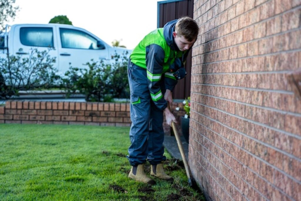
Exclusion techniques focus on preventing future infestations by sealing entry points identified during inspection. Technicians use materials such as steel mesh, caulk, or weather stripping to block gaps in walls, roofs, doors, and windows.
Habitat modification involves making changes to the environment that discourage pests from thriving. This may include removing clutter, fixing leaks, trimming vegetation, or storing food properly.
How Do Technicians Ensure Long-Term Pest Prevention?
Ongoing prevention strategies complement elimination efforts to achieve lasting results. Technicians provide recommendations tailored to your property’s specific needs based on their findings during inspection and treatment.
These suggestions may include:
Regular maintenance practices such as cleaning gutters, clearing debris, and maintaining landscaping
Implementing integrated pest management (IPM) techniques that combine cultural, physical, and biological controls alongside chemical treatments
Educating occupants about pest behaviour and prevention measures
By addressing the underlying factors contributing to infestations and empowering homeowners with knowledge, professional pest control services aim to break the cycle of recurring pest problems.
Why Choose Professional Pest Control Over DIY Methods?
While there are various do-it-yourself (DIY) approaches available for pest management, professional services offer distinct advantages:
Expertise: Licensed technicians possess specialised knowledge gained through training and experience that enables them to accurately identify pests and devise effective solutions.
Safety: Professionals adhere to strict safety protocols when handling pesticides and other treatments, minimising risks to humans and pets.
Efficiency: With access to commercial-grade products and equipment not available to consumers, professionals can achieve faster results compared to DIY methods.
Comprehensive approach: Professionals consider multiple factors influencing pest problems—such as property layout, landscaping features—and tailor their strategies accordingly rather than relying solely on generic treatments.
Long-term benefits: By addressing root causes rather than just symptoms of infestations, professional services aim for sustainable outcomes that reduce likelihood of future pest issues.
Conclusion
Professional pest control services play a crucial role in safeguarding homes in Sydney from unwanted invaders. Through meticulous inspections, targeted elimination techniques, ongoing prevention strategies implemented by licensed technicians who understand local conditions—these experts provide comprehensive solutions tailored to each property’s unique needs.
If you’re facing a pest problem or want proactive measures against potential infestations—consider reaching out to trusted professionals who can help protect your home effectively!
What Safety Measures Are Used in Residential Pest Control?
Professional pest control companies prioritise pest control safety standards that protect both residents and their pets during treatment applications. Reputable Sydney providers implement strict protocols ensuring treatments eliminate pests without compromising household health.
Why Safety Matters for Your Family and Pets
Pest control treatments involve chemicals and techniques that require careful handling. Children, elderly family members, and pets face heightened vulnerability to improper pesticide exposure. Licensed technicians assess each home’s unique circumstances—noting the presence of aquariums, food preparation areas, and pet habitats—before selecting appropriate treatment methods. This personalised approach ensures safe pest treatments that target pests whilst minimising risks to household occupants.
Industry Certifications That Guarantee Quality
HACCP compliance represents a critical benchmark in pest control safety standards. This certification system, originally developed for food safety, ensures companies follow rigorous hygiene and contamination prevention protocols. Sydney pest control providers holding HACCP accreditation demonstrate their commitment to:
Systematic hazard analysis at every treatment stage
Critical control point monitoring during service delivery
Documented procedures for chemical handling and storage
Regular staff training on safety protocols
Traceability systems for all products used
Licensed technicians must complete ongoing education requirements and maintain current certifications from regulatory bodies. These qualifications verify their knowledge of proper application rates, restricted chemicals, and environmental protection measures.
How Companies Minimise Health Risks During Treatment
Modern pest control companies employ multiple strategies to ensure safe application. Technicians conduct thorough pre-treatment consultations, explaining which products will be used and any necessary preparation steps. Homeowners receive clear instructions about:
Recommended evacuation periods for treated areas
Proper ventilation requirements post-treatment
Safe re-entry timeframes for different household members
Storage of food items and kitchen utensils
Pet relocation during and after service
Low-toxicity formulations have become standard in residential applications. Many Sydney providers now offer botanical-based treatments and targeted gel baits that reduce broadcast spraying. These products break down quickly in the environment whilst maintaining effectiveness against pests.
Digital application records track exactly which products were used, where they were applied, and in what quantities. This documentation proves invaluable should any concerns arise and demonstrates
What Service Features Can Homeowners Expect from Pest Control Companies?
How Does Flat-Rate Pricing Work?
Flat-rate pricing pest control eliminates surprise costs by offering homeowners a single, transparent price for general pest treatments. This pricing model covers the inspection, treatment application, and follow-up services for common household pests like ants, cockroaches, and spiders. Homeowners know exactly what they’ll pay before technicians arrive, making budgeting straightforward and removing the anxiety of hidden fees or hourly rate escalations.
What Are the Benefits of Flat-Rate Pricing?
The flat-rate structure typically includes treatment for multiple pest types in a single visit. A technician might address a cockroach problem in the kitchen whilst simultaneously treating an ant infestation in the living areas and applying preventative barriers around entry points. This comprehensive approach delivers better value than paying separately for each pest issue.
How Do Warranty Services Protect Your Investment?
Warranty services provide homeowners with assurance that pest control treatments will deliver lasting results. Most Sydney providers offer warranties ranging from three to twelve months, depending on the treatment type and pest species targeted. If pests return within the warranty period, technicians will retreat the property at no additional charge.
These guarantees demonstrate a company’s confidence in their methods and products. A six-month warranty on general pest treatment means the provider stands behind their work and will address any resurgence of treated pests. Homeowners should request warranty details in writing, including specific coverage terms and any conditions that might void the protection.
What Rodent Control Techniques Do Professionals Use?
Rodent control techniques combine multiple strategies to eliminate existing populations and prevent future infestations. Baiting stations placed strategically around the property contain rodenticides that mice and rats consume before returning to their nests. These tamper-resistant stations keep toxic substances away from children and pets whilst targeting rodent activity zones.
Trapping methods range from snap traps for immediate results to live-catch traps for humane removal. Technicians position traps along rodent pathways, near droppings, or in areas showing gnaw marks. The placement requires expertise to maximise capture rates whilst minimising risk to household members.
Exclusion methods seal entry points that rodents use to access homes. Professionals identify gaps around pipes, cracks in foundations, and openings near roofs as potential entryways. By sealing these vulnerabilities with materials like steel wool or caulk, technicians create barriers that deter rodents from entering living spaces.
Why Are Integrated Pest Management (IPM) Practices Important?
Integrated Pest Management (IPM) practices prioritise long-term solutions over short-term fixes by addressing underlying factors contributing to infestations. Pest control companies implementing IPM assess environmental conditions such as sanitation issues or structural deficiencies that attract pests.
By combining various techniques—biological controls, habitat modification, cultural practices—alongside chemical treatments when necessary, IPM aims for sustainable pest management outcomes while minimising risks associated with pesticide use.
Homeowners can inquire about their chosen provider’s approach towards IPM during consultations as it reflects commitment towards environmentally friendly practices without compromising effectiveness against pests.
How Can You Benefit from Ongoing Maintenance Plans?
Ongoing maintenance plans offer homeowners proactive measures against recurring pest problems through regular inspections and treatments based on specific needs identified during initial visits. These plans often come at discounted rates compared to one-time services making them cost-effective options for long-term prevention strategies.
During scheduled appointments, technicians evaluate previous treatments’ effectiveness monitor signs of new infestations recommend corrective actions if required—all aimed at maintaining pest-free environments throughout properties consistently over time.
Homeowners interested in such plans should discuss available options with prospective pest control companies ensuring they align with individual requirements budgets expectations set forth initially while seeking professional assistance combating unwanted invaders!
Why Are Termite Inspections and Protection Plans Essential in Sydney?
Sydney’s warm, humid climate creates ideal breeding conditions for termites, making regular inspections and protection plans critical for preventing devastating structural damage. The region’s consistent moisture levels and mild winters allow termite colonies to remain active year-round, unlike cooler climates where pest activity naturally decreases.
The Hidden Threat in Sydney’s Climate
Subterranean termites thrive in Sydney’s environment, establishing colonies that can contain millions of individuals. These pests consume timber silently within wall cavities, floor joists, and roof structures before homeowners notice any visible signs. A single colony can consume approximately 13 pounds of timber per week, compromising the structural integrity of a property within months.
The coastal areas and suburbs near waterways face particularly high risk due to elevated humidity levels. Properties in Campbelltown, Penrith, and the northern beaches experience consistent termite pressure throughout the year, requiring vigilant monitoring.
Early Detection Through Professional Inspections
Annual termite inspections Sydney services identify infestations before significant damage occurs, potentially saving homeowners tens of thousands in repair costs. Licensed technicians use thermal imaging cameras, moisture meters, and acoustic detection devices to locate termite activity within concealed spaces.
Inspections typically cover:
All accessible timber structures including frames, flooring, and roof spaces
External perimeter areas where termites enter properties
Subfloor spaces and wall cavities
Garden beds, tree stumps, and timber landscaping features adjacent to buildings
Properties built before 2000 often lack modern termite barriers, making them especially vulnerable. Inspections reveal these weaknesses and allow for targeted protection strategies.
Comprehensive Protection Plans
Termite protection plans establish defensive barriers around properties using chemical treatments, physical barriers, or monitoring stations that prevent colony access. These systems work continuously to safeguard homes between annual inspections.
Chemical barrier treatments involve applying termiticides to the soil around a building’s perimeter. Termites contacting the treated zone either die or avoid the area entirely. These barriers typically remain effective for five to eight years depending on soil conditions and product specifications.
How Do Seasonal Pest Control Packages Provide Year-Round Protection?
Seasonal pest control packages in Sydney offer continuous protection by addressing the changing patterns of pest activity throughout the year. Different pests emerge, breed, and invade homes during specific seasons based on temperature, humidity, and food availability in Sydney’s climate.
Spring (September-November)
During spring, we can expect to see an increase in activity from ants, spiders, and termites as the warmer weather triggers their breeding cycles. This is the time when colonies expand rapidly, leading to a peak season for Argentine ant invasions and funnel-web spider sightings. It’s also when termites swarm to establish new colonies, posing a greater risk of structural damage.
Summer (December-February)
In summer, cockroach populations become more intense, especially German and American species that thrive in hot, humid conditions. Mosquitoes breed prolifically in standing water, while flies become persistent nuisances around homes. Wasps and bees take this opportunity to construct nests in roof cavities and garden areas during these months.
Autumn (March-May)
As temperatures begin to drop in autumn, rodents start seeking shelter. Mice and rats infiltrate homes through small gaps in search of warmth and food sources. Spiders also move indoors to escape the cooling outdoor conditions, resulting in increased encounters with redbacks and house spiders.
Winter (June-August)
Winter drives more rodents indoors, making it the primary season for mouse and rat infestations. Cockroaches retreat to warm indoor environments such as kitchens and bathrooms. Silverfish populations remain active throughout the year but become more noticeable as they seek moisture in heated homes.
Year-round pest prevention through seasonal packages addresses these cyclical patterns with treatments timed to intercept pest activity before infestations develop. Rather than waiting for visible problems to arise, scheduled services target pests during vulnerable stages of their life cycles.
Benefits of tailored seasonal treatments include:
Pre-emptive barrier applications before peak breeding seasons reduce the likelihood of colony establishment
Targeted treatments for specific pests when they’re most active ensure maximum effectiveness
Regular monitoring identifies emerging problems before they escalate into costly infestations
Consistent protection maintains chemical barriers and treatment zones throughout the year
Cost savings compared to emergency callouts for severe infestations that develop unchecked
What Specialized Services Do Pest Control Providers Offer for Specific Needs?
End-of-Lease Pest Control
End-of-lease pest control Sydney services address mandatory requirements for rental properties, ensuring tenants and landlords meet their legal obligations. Most rental agreements stipulate professional pest treatment before lease termination, covering cockroaches, ants, fleas, and other common household pests. These comprehensive treatments provide documented proof of service, protecting security deposits and maintaining property standards.
Licensed technicians conduct thorough inspections of the entire property, treating all rooms, cupboards, skirting boards, and potential pest harbourage areas. The service typically includes a certificate of treatment, which landlords require as evidence of compliance. Many providers offer same-day or next-day appointments to accommodate tight moving schedules, with treatments designed to be effective yet quick-drying to allow immediate access.
Wasp and Bee Management
Wasp nest removal requires specialized expertise due to the aggressive nature of these insects, particularly European wasps and paper wasps common in Sydney. Professional technicians use protective equipment and targeted treatments to safely eliminate nests without endangering residents or pets. The process involves identifying nest locations—often in roof cavities, wall voids, or garden areas—before applying appropriate insecticides.
Bee populations receive different treatment approaches depending on the species. Native bees and honeybees may be relocated rather than exterminated, preserving these beneficial pollinators whilst removing the threat from residential areas. Pest control providers assess each situation individually, determining whether removal, relocation, or exclusion methods best suit the circumstances.
Prevention strategies include:
Sealing entry points around eaves and roof spaces
Removing attractants such as exposed food and sweet drinks
Installing screens on windows and vents
Regular property inspections during warmer months when activity peaks
Indoor Air Quality Solutions
Mould treatment services target fungal growth that compromises indoor air quality and poses health risks to occupants. Sydney’s humid climate creates ideal conditions for mould proliferation, particularly in bathrooms, kitchens, laundry areas, and poorly ventilated spaces. Professional treatments eliminate existing mould colonies and address the underlying moisture issues causing growth.
Technicians apply antimicrobial solutions that kill mould spores at the source, preventing regrowth. In addition to eradication efforts, pest control providers offer recommendations on improving ventilation systems or using dehumidifiers as long-term solutions for mould prevention.
These specialised services provided by pest control providers cater to specific needs beyond general pest management. By addressing end-of-lease requirements, managing wasp and bee populations responsibly, and tackling mould issues effectively; these professionals contribute towards creating safe environments both in rental properties and residential spaces throughout Sydney.
Which Areas in Metropolitan Sydney Receive Residential Pest Control Services?
Professional pest control services extend throughout metropolitan Sydney, ensuring homeowners across the region can access expert protection. Licensed technicians operate in suburbs spanning from the city centre to outer metropolitan zones, covering both established neighbourhoods and rapidly growing residential developments.
Coverage Across Key Suburban Regions
Kellyville – Rapid residential development in this Hills District suburb requires proactive pest management for new and established homes
Rouse Hill – Growing family neighbourhoods benefit from comprehensive treatments addressing ants, cockroaches, and seasonal spider activity
Northern Beaches – Coastal properties face unique challenges from moisture-loving pests including silverfish, cockroaches, and mould growth
Inner West – Dense urban housing requires specialised approaches for bed bugs, German cockroaches, and rodent control
Eastern Suburbs – Established homes need regular termite inspections and preventative treatments against persistent ant colonies
Service providers maintain local knowledge of pest behaviour patterns specific to each region’s climate, housing types, and environmental conditions. This geographical expertise allows technicians to recommend treatment schedules aligned with seasonal pest activity in different metropolitan zones.
Accessibility remains a priority, with same-day or next-day appointments available across most suburbs. Mobile service units equipped with professional-grade equipment travel to residential properties, eliminating the need for homeowners to transport pest samples or visit physical offices.
Specific Pest Control Services in Selected Areas
Campbelltown
Campbelltown pest services reach homes throughout the southwestern corridor, addressing pest challenges unique to this area’s mix of suburban housing and bushland interfaces. The region’s proximity to natural habitats increases exposure to native spiders, rodents, and termites, making regular professional treatments essential for property protection.
Penrith
Penrith rodent control specialists serve the western suburbs where residential areas meet agricultural zones and waterways. These environmental factors create ideal conditions for mouse and rat populations, particularly during seasonal temperature changes. Technicians in this region employ targeted baiting systems and exclusion techniques suited to the area’s specific pest pressures.
How Does a Proactive and Preventative Approach Benefit Homeowners?
Proactive pest management Sydney strategies stop infestations before they start, saving homeowners thousands in potential damage and treatment costs. Early detection through regular monitoring identifies pest activity at its earliest stages, when elimination is simplest and least expensive.
What Makes Early Detection So Valuable?
Catching pests during initial entry prevents colonies from establishing themselves in wall cavities, roof spaces, or beneath flooring. A single termite spotted during a routine inspection can reveal a larger colony before structural damage occurs. Regular monitoring appointments create a timeline of your property’s pest activity, allowing technicians to spot unusual patterns immediately.
Digital monitoring systems track rodent movements 24/7, alerting professionals to new activity within hours rather than weeks. This technology transforms preventative home protection from periodic treatments into continuous surveillance.
How Does Prevention Compare to Reactive Treatment Costs?
Reactive pest control addresses established infestations, which require:
Multiple treatment visits instead of single applications
Stronger chemical concentrations to penetrate nesting areas
Structural repairs from pest damage (termite-weakened timber, rodent-chewed wiring)
Replacement of contaminated insulation or stored items
Professional cleaning after severe cockroach or rodent infestations
Scheduled preventative treatments cost a fraction of emergency callouts. Seasonal packages spread costs across the year whilst maintaining constant protection against Sydney’s changing pest pressures.
What Health Benefits Come from Ongoing Protection?
Preventing pest establishment protects residents from allergens, pathogens, and stress. Cockroach droppings trigger asthma attacks, particularly in children. Rodent urine contaminates surfaces with harmful bacteria. Spider bites, whilst rare, pose serious risks when venomous species nest near living areas.
The answer includes safeguarding indoor air quality through mould prevention and eliminating pest waste before it accumulates. Homes under preventative plans maintain healthier environments year-round.
Why Does Continuous Monitoring Improve Living Comfort?
Knowing your home receives regular professional attention provides peace of mind that reactive approaches cannot match. Scheduled visits mean you’re never wondering whether pests are silently invading your space.
FAQs (Frequently Asked Questions)
What is residential pest control in Sydney and why is it important for homeowners?
Residential pest control in Sydney involves managing and eliminating common pests found in homes within the region’s climate and urban environment. It is crucial for homeowners to protect their properties from damage, maintain hygiene, and ensure a safe living environment by preventing infestations of pests such as ants, cockroaches, spiders, rodents, and termites.
Which are the most common pests found in Sydney homes?
Sydney homes commonly face infestations from kitchen ants including Argentine ants, German and Australian cockroaches, spiders like funnel-webs and redbacks, rodents such as mice and rats, as well as bed bugs, fleas, silverfish, wasps, bees, crickets, and moths. Awareness of these pests helps in effective management and prevention.
How do professional pest control services protect homes in Sydney?
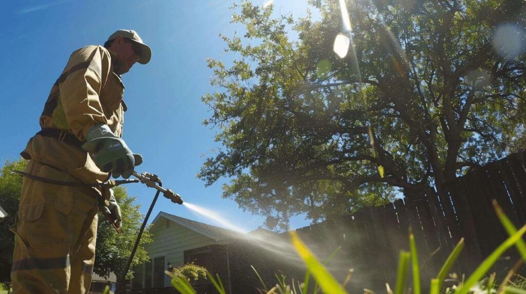
Licensed pest control technicians conduct thorough inspections to identify pest types and infestation levels. They employ elimination methods including safe pesticides, traps, fumigation, alongside digital monitoring technologies to manage ongoing pest activity. Prevention strategies are also implemented to reduce future risks effectively.
What safety measures are used during residential pest control treatments?
Pest control companies in Sydney adhere to strict safety standards such as HACCP compliance to ensure treatments are safe for homeowners and pets. Certified professionals apply pest control products carefully to minimize health risks while effectively eliminating pests from residential properties.
Why are termite inspections and protection plans essential for Sydney homes?
Due to Sydney’s climate, termites pose a significant risk of structural damage to homes. Regular termite inspections enable early detection of infestations while protection plans provide ongoing prevention measures. These services help safeguard property integrity and reduce costly repairs caused by termite activity.
How do seasonal pest control packages provide year-round protection for Sydney residences?
Seasonal pest control packages are tailored treatments that address variations in pest activity throughout the year in Sydney. By scheduling targeted interventions each season, homeowners benefit from continuous protection against emerging pests, ensuring their homes remain comfortable and pest-free all year round.
Why Is Comprehensive Pest and Termite Treatment Indispensable for Health Protection and Property Preservation?
Comprehensive pest and termite treatment protects your family’s health whilst preserving your property’s structural integrity and market value. Without proper intervention, infestations escalate rapidly, transforming minor nuisances into severe health hazards and costly structural repairs.
The importance of comprehensive pest treatment extends far beyond simply eliminating visible pests. Professional services identify hidden colonies, treat root causes, and implement preventive strategies that standard DIY methods cannot match. A single termite colony can consume several kilograms of wood monthly, whilst rodent droppings contaminate surfaces with dangerous pathogens.
Understanding the Need for Comprehensive Pest and Termite Treatment
To understand why comprehensive pest and termite treatment is necessary, we need to look at several key factors:
Health risks: Disease-carrying pests like rodents and cockroaches pose a threat to human health.
Structural damage: Wood-boring insects and gnawing rodents can cause significant harm to buildings.
Professional inspection protocols: Trained experts follow specific procedures to uncover the true extent of infestations.
Maintenance programmes: Regularly scheduled activities help prevent pests from returning.
Food safety measures: Steps are taken to ensure that food remains uncontaminated by pests.
Preventive strategies: Long-lasting barriers are put in place to keep pests away.
Property owners who invest in comprehensive treatment benefit from reduced medical expenses, avoided structural repairs, and maintained property values. The cost of professional pest management represents a fraction of potential damages from unchecked infestations, making it an essential investment in both health protection and property preservation.
What Health Risks Do Pests Like Rodents and Cockroaches Pose?
Rodents and cockroaches carry numerous pathogens that directly threaten human health through contamination of surfaces, food, and air. These health risks pests introduce range from mild allergic reactions to severe, potentially fatal diseases that require immediate medical intervention.
Disease Transmission from Common Household Pests
Rodents are known to spread over 35 diseases that can be transmitted to humans through direct contact with their droppings, urine, saliva, or bites. One such disease is Hantavirus pulmonary syndrome, which is a potentially deadly respiratory illness that occurs when humans inhale dust contaminated with rodent droppings. Another disease is leptospirosis, which enters the body through cuts or mucous membranes after coming into contact with water or soil contaminated by infected rodent urine. This can lead to symptoms such as high fever, kidney damage, and liver failure.
Cockroaches also carry harmful pathogens on their bodies and in their waste. These insects often crawl through dirty places like sewers and rubbish bins before making their way onto kitchen surfaces and food preparation areas. They can transmit salmonella, which causes food poisoning, and E. coli bacteria, leading to severe stomach problems.
The Link Between Cockroach Allergies and Respiratory Problems
Cockroach allergies develop from exposure to proteins found in cockroach saliva, droppings, and decomposing body parts. These allergens become airborne as microscopic particles that people inhale, triggering immune system responses. Studies show that cockroach allergens rank amongst the most common triggers for asthma attacks, particularly in urban environments with high infestation rates.
Children living in homes with cockroach infestations face significantly elevated risks of developing asthma or experiencing severe asthma symptoms. The allergens cause inflammation in airways, leading to:
Persistent coughing and wheezing
Chest tightness and shortness of breath
Sleep disruption due to breathing difficulties
Increased frequency of emergency hospital visits
Individuals with existing respiratory conditions experience worsened symptoms when exposed to these allergens, even in relatively small quantities.
How Do Pests Cause Structural Damage to Properties?
Pests create serious structural damage by gnawing through essential building materials that compromise structural integrity. Rodents possess continuously growing teeth that drive them to chew constantly on wood beams, wall insulation, and plastic piping to keep their incisors filed down, creating entry points for moisture and weakening load-bearing structures.
The destruction extends beyond visible surfaces into hidden areas where pests operate undetected for months. Rats and mice tunnel through wall cavities, shredding insulation that reduces energy efficiency and creates nesting materials. Their relentless chewing habits target electrical wiring, stripping away protective plastic coating to expose live copper wires.
Fire Hazards from Electrical Damage
Damaged electrical wiring represents one of the most dangerous property risks associated with pest infestations. When rodents gnaw through wire insulation, they create exposed conductors that can spark and ignite surrounding flammable materials like insulation, timber framing, or stored items. Insurance claims frequently cite rodent damage to electrical systems as the cause of residential and commercial fires.
The hidden nature of this damage makes it particularly hazardous—property owners often remain unaware until smoke detectors activate or visible signs of fire appear. Electrical shorts caused by pest damage can also trip circuit breakers repeatedly, damage appliances, and create power surges throughout the building.
The Devastating Impact of Termite Damage
Termite damage stands as the most financially catastrophic form of pest-related destruction, costing Australian property owners billions of dollars annually. These silent destroyers consume cellulose in wood 24 hours a day, hollowing out structural timbers, floor joists, and roof supports while leaving only a thin veneer that masks the extensive internal damage.
Subterranean termites build mud tubes along foundation walls to access above-ground timber, working their way through:
Floor joists and support beams
Wall studs and window frames
Roof trusses and eaves
Skirting boards and door frames
Built-in cabinetry and furniture
A mature termite colony containing millions of workers can consume approximately 13 pounds of wood per year. The damage often goes unnoticed.
Why Is a Detailed Inspection Crucial in Pest and Termite Treatment?
A detailed inspection is essential for effective pest and termite treatment. It uncovers the full extent and specific locations of infestations that may not be apparent to untrained individuals. Without a proper assessment, treatments only target visible signs while hidden colonies continue to grow behind walls, under floors, or in roof spaces.
Trained professionals bring specialised expertise to pest inspection importance. These experts recognise subtle indicators that homeowners typically overlook—faint trails of termite mud tubes, barely noticeable droppings in concealed corners, or minor structural weaknesses signalling extensive damage. Their experience allows them to distinguish between different pest species, each requiring unique treatment approaches. A cockroach infestation demands vastly different solutions compared to a termite colony, and misidentification leads to wasted resources and continued property deterioration.
The Science Behind Professional Infestation Identification
Professional pest reports document findings with precision that guides targeted treatment strategies. Inspectors use thermal imaging cameras to detect heat signatures from active termite colonies within walls. Moisture metres identify damp areas where pests congregate. Borescopes allow visual examination of wall cavities and subfloor spaces without destructive investigation.
These technological tools complement hands-on inspection techniques:
Tapping timber to detect hollow sounds indicating termite damage
Examining foundation perimeters for entry points and moisture issues
Checking roof voids where rodents commonly nest
Inspecting plumbing areas prone to cockroach activity
Assessing garden perimeters for ant colonies near structures
Root Cause Treatment Versus Surface Solutions
Thorough inspections enable pest control professionals to identify why infestations occur, not just where pests currently reside. A cockroach problem might stem from a leaking pipe creating ideal moisture conditions. Rodent entry could result from deteriorated weatherstripping or gaps around utility penetrations. Termites often exploit poor drainage causing timber moisture levels to rise above safe thresholds.
Understanding the Need for Comprehensive Pest and Termite Treatment becomes clear when comparing inspection-based approaches to superficial fixes. Spraying visible cockroaches provides temporary relief but fails when the underlying moisture problem persists. Click here to get more about protecting your home: what is residential pest control Sydney?
What Are the Benefits of Regular Pest Control Maintenance Programmes?
Pest control maintenance programmes create a protective barrier that works year-round, preventing infestations before they establish themselves on your property. These scheduled services address pest activity at different life stages, catching problems early when they’re easiest to manage.
How Often Should You Schedule Pest Control Visits?
The frequency of visits depends on your property’s risk factors and pest pressure:
Monthly programmes suit high-risk environments like restaurants, food processing facilities, or properties with persistent pest issues
Semi-annual treatments work well for moderate-risk homes and businesses in suburban areas with seasonal pest activity
Annual inspections provide baseline protection for low-risk properties in areas with minimal pest pressure
Properties near bushland, water sources, or agricultural areas typically require more frequent attention than those in urban centres with less pest habitat nearby.
Why Does Regular Treatment Prevent Re-Infestation?
Re-infestation prevention relies on consistent monitoring and treatment before pest populations rebuild. A single treatment eliminates existing pests but doesn’t stop new ones from entering your property. Scheduled visits create overlapping protection periods that interrupt breeding cycles.
Pests reproduce rapidly—a single cockroach pair can produce 400,000 offspring in one year. Regular treatments target eggs, larvae, and adults at vulnerable points in their development, breaking the reproductive chain before populations explode.
What Makes Maintenance Plans More Effective Than Reactive Treatments?
Ongoing pest prevention through maintenance plans costs significantly less than emergency treatments for established infestations. Technicians become familiar with your property’s unique vulnerabilities, adjusting strategies based on seasonal patterns and previous findings.
Maintenance programmes include:
Exterior perimeter treatments that create defensive barriers
Interior monitoring stations that detect early warning signs
Roof void inspections for rodent and termite activity
Documentation tracking pest trends over time
Seasonal adjustments addressing specific pest behaviours
Properties enrolled in maintenance programmes experience 85% fewer emergency callouts compared to those relying on reactive treatments. The predictable scheduling also allows property managers to budget accurately for pest control expenses rather than facing unexpected costs from severe infestations.
How Do Professional Services Safeguard Food Safety from Pest Contamination?
Food safety pests pose immediate threats to any environment where food is stored, prepared, or served. Cockroaches, rodents, ants, and flies carry pathogens on their bodies and through their droppings, contaminating surfaces, packaging, and food products themselves. A single mouse can produce up to 75 droppings daily, spreading bacteria like Salmonella and E. coli throughout pantries and kitchens.
Professional pest control services implement multi-layered strategies to protect food storage and service areas from contamination. These specialists understand that pantry contamination prevention requires more than reactive treatments—it demands systematic environmental modifications and ongoing vigilance.
Critical Entry Point Management
Pests exploit surprisingly small gaps to access food sources. Mice can squeeze through openings as narrow as 6mm, whilst cockroaches flatten their bodies to slip through cracks barely visible to the naked eye. Professional services conduct thorough perimeter inspections to identify and seal these vulnerabilities:
Door sweeps and weather stripping on exterior doors
Caulking and expanding foam for gaps around pipes and utility lines
Wire mesh screens over vents and drainage openings
Gap repairs beneath skirting boards and around cupboard bases
Strategic Food Storage Protocols
Proper storage practices create barriers between pests and potential food sources. Professionals advise facilities and homeowners to implement these protective measures:
Transfer dry goods from cardboard or paper packaging into airtight containers made of glass, metal, or heavy-duty plastic
Store items on shelving units raised at least 15cm off the floor to allow inspection and cleaning
Implement first-in, first-out rotation systems to prevent forgotten items from attracting pests
Keep pet food in sealed containers rather than leaving bags open
Water Source Elimination
Standing water and moisture attract pests seeking hydration and breeding grounds. Cockroaches, in particular, can survive weeks without food but only days without water. Professional services identify and address moisture issues that support pest populations:
Repairing leaking pipes, taps, and appliances
Installing dehumidifiers in damp areas
Ensuring proper drainage systems are in place
By actively managing entry points, implementing strategic food storage protocols, and eliminating water sources, professional pest control services play a crucial role in safeguarding food safety from pest contamination.
What Preventive Measures Are Essential for Effective Pest Management?
Effective pest management relies on a multi-layered approach that addresses potential vulnerabilities before infestations occur. Understanding the need for comprehensive pest and termite treatment begins with implementing proven pest prevention methods that create inhospitable environments for unwanted invaders.
Sealing Entry Points
Pests exploit even the smallest openings to access your property. Gaps around pipes, cracks in foundations, and holes in exterior walls serve as highways for rodents, cockroaches, and ants seeking shelter and food.
Critical areas requiring attention include:
Window and door frames where weatherstripping has deteriorated
Utility line penetrations through walls and floors
Foundation cracks wider than 1/8 inch
Roof vents and chimney openings without proper screening
Gaps beneath doors exceeding 6 millimetres
Silicone-based caulk works effectively for smaller cracks, whilst expanding foam fills larger voids. Steel wool combined with caulk prevents rodents from chewing through sealed areas. Copper mesh provides durable protection around pipes where flexibility matters.
Strategic Use of Repellents
Repellents create chemical or natural barriers that deter pests from entering treated zones. Professional-grade products contain active ingredients like pyrethroids or permethrin that remain effective for extended periods.
Natural alternatives include peppermint oil for mice, diatomaceous earth for crawling insects, and cedar oil for various pests. These options suit households preferring non-toxic solutions, though they require more frequent reapplication than synthetic products.
Perimeter treatments around building exteriors establish protective zones. Applying repellents along baseboards, behind appliances, and in attics targets common pest pathways. Granular formulations work well outdoors, whilst sprays and gels suit indoor applications.
Maintaining Cleanliness Standards
Pests thrive in environments offering easy access to food and shelter. Crumbs on countertops, grease splatter behind cookers, and food debris in bins attract cockroaches and ants within hours.
Daily cleaning routines should incorporate:
Wiping down surfaces immediately after food preparation
Sweeping and vacuuming regularly to eliminate crumbs
Keeping rubbish bins sealed tightly and disposing of waste frequently
Storing food in airtight containers to prevent odours from luring pests
Conclusion
Understanding the need for comprehensive pest and termite treatment transforms how you protect what matters most. The importance of comprehensive pest treatment holds extends far beyond eliminating visible pests—it creates a defensive barrier around your health, property value, and daily comfort.
Waiting until an infestation becomes obvious often means the damage has already begun. Termites silently weaken structural timber whilst rodents gnaw through electrical wiring behind your walls. Cockroaches contaminate food preparation surfaces with pathogens that trigger respiratory conditions in vulnerable family members.
A proactive approach delivers measurable advantages:
Health protection through elimination of disease vectors and allergen sources
Financial savings by preventing costly structural repairs and property devaluation
Peace of mind knowing trained professionals monitor your premises regularly
Food safety maintained through systematic contamination prevention
Long-term security via maintenance programmes that stop re-infestation
Professional pest control isn’t an expense—it’s an investment in your property’s future and your family’s wellbeing. The cost of comprehensive treatment pales against potential medical bills, structural repairs, or the stress of discovering an advanced infestation.
Take action before pests take control. Schedule a detailed inspection with qualified professionals who understand local pest behaviour patterns and treatment methodologies. Whether you choose annual, semi-annual, or monthly maintenance, consistent vigilance keeps your environment safe and pest-free.
Your home or business deserves protection that addresses root causes rather than symptoms. Prioritise comprehensive pest and termite treatment today—because prevention always costs less than cure, and your peace of mind is priceless.
FAQs (Frequently Asked Questions)
Why is comprehensive pest and termite treatment essential for health protection and property preservation?
Comprehensive pest and termite treatment is vital because it safeguards your health by preventing diseases carried by pests like rodents and cockroaches, and preserves property value by addressing structural damages caused by termites and other pests. It ensures a proactive approach to maintaining a safe and secure living environment.
What health risks do pests such as rodents and cockroaches pose?
Rodents can spread bacterial infections, while cockroaches are known to trigger allergies and asthma. Both pests carry various diseases that can compromise human health, making their control crucial in preventing illness and allergic reactions.
How do pests cause structural damage to properties?
Pests like termites chew through wood, insulation, and electrical wiring, leading to significant structural damage. Damaged wiring from pests can also create fire hazards. Termites alone account for billions in damages due to their destructive impact on property integrity.
Why is a detailed inspection important in pest and termite treatment?
A detailed inspection by trained professionals identifies the extent of infestation accurately. This allows for effective treatment targeting the root causes rather than superficial fixes, ensuring long-term protection against pests.
What are the benefits of regular pest control maintenance programs?
Regular maintenance programs, whether annual, semi-annual, or monthly, help prevent re-infestation by providing continuous protection. These ongoing treatments ensure that pest populations remain under control, safeguarding your health and property consistently.
How do professional services help safeguard food safety from pest contamination?
Professional services prevent pests from invading food storage and service areas by sealing entry points, promoting proper food storage practices, and eliminating standing water sources. These measures effectively reduce the risk of pantry contamination caused by pests.
In the competitive and fast-paced world of real estate, securing the right property at the right price can feel like a daunting challenge. For property investors, this task becomes even more complex, especially in a high-demand market like Bondi. As one of Australia’s most sought-after suburbs, Bondi offers an array of opportunities—but also plenty of risks for the unprepared. That’s where a buyers agency comes in. A buyers agency represents your best interests throughout the entire property-buying process, providing you with tailored strategies designed to help you find, negotiate, and secure the perfect investment.
A buyers agency is a professional service dedicated to helping buyers navigate the often-overwhelming process of purchasing real estate. Unlike real estate agents, who work for sellers, buyers agents represent you, the buyer. They are experts in identifying opportunities, negotiating deals, and managing the complexities of the property market. When it comes to property investing in Bondi, a buyers agency can be the key to unlocking hidden gems and achieving long-term success.
Bondi’s property market is unlike any other in Australia. With its desirable location by the beach, vibrant community, and rich cultural offerings, properties in Bondi are in high demand. The challenge for property investors is identifying properties that offer long-term growth potential, rather than getting caught up in the immediate appeal of a trendy area.
This is where a buyers agency’s deep local expertise comes into play. A skilled buyers agent will have a comprehensive understanding of Bondi’s market trends, property values, and the factors that influence growth. Whether it’s identifying up-and-coming areas, assessing the potential for capital appreciation, or understanding local zoning laws, their market knowledge helps you make an informed decision.
In addition, buyers agents know which properties are truly undervalued or overpriced. With their finger on the pulse of Bondi’s real estate landscape, they can help you avoid properties that may seem appealing but lack the potential for long-term returns. This expertise not only ensures you’re making a smart investment but helps protect you from costly mistakes.
Time-Saving Benefits
Property investing is an inherently time-consuming process. From researching potential properties to arranging viewings, coordinating inspections, and dealing with legal paperwork, the time and effort required can quickly add up. Working with a buyers agent can significantly reduce the time you spend on these tasks, freeing up your schedule for other important aspects of your life or business.
A buyers agent takes care of the legwork—researching and presenting only the most promising properties that fit your criteria. They also handle the logistics of viewings, inspections, and meetings with agents, saving you countless hours of research and travel time. Furthermore, they manage all the documentation, ensuring that legal matters are handled smoothly and efficiently. With a buyers agent managing the details, you can focus on making key investment decisions without getting bogged down in the process.
Access to Off-Market Properties
In a high-demand market like Bondi, many of the best investment opportunities are never listed publicly. These off-market properties—often referred to as “exclusive” or “hidden” properties—are typically sold before they even make it to the public listings. This gives buyers who have access to off-market opportunities a significant advantage, as they can purchase properties before competition even begins.
Buyers agents have established networks and relationships with real estate professionals, which often grant them early access to off-market deals. By working with a buyers agency, you’re not limited to the properties you see on public listings. Instead, you get access to exclusive opportunities that are often unavailable to the general market. This early access can be the difference between securing a dream investment and missing out to other buyers.
Negotiation Skills & Cost Savings
Negotiating the best deal is one of the most important aspects of property investing. Without the right negotiation skills, you could end up overpaying for a property or settling for less than ideal terms. This is particularly true in competitive markets like Bondi, where multiple offers can drive up prices and push buyers to make hasty decisions.
A buyers agent’s negotiation skills are invaluable. They are trained to handle competitive bidding situations, leverage market knowledge, and negotiate favorable terms for their clients. Whether it’s reducing the asking price, asking for repairs, or securing better contract terms, a buyers agent works to ensure you get the best deal possible.
In addition to saving you money on the purchase price, buyers agents are skilled at negotiating other aspects of the deal, such as financing terms and settlement periods. By ensuring that all aspects of the transaction work in your favor, they help you maximize the long-term returns on your investment.
Stress-Free Experience
Investing in property can be stressful, especially when dealing with multiple offers, tight deadlines, and complex paperwork. For property investors, the stakes are often higher, as every decision can significantly impact the overall return on investment. A buyers agency helps take the stress out of the process by managing all the details on your behalf.
From the moment you first engage with a buyers agent, they will guide you through each step of the investment process. They handle everything from researching suitable properties and coordinating viewings to managing inspections, liaising with sellers and agents, and ensuring all legal matters are taken care of. With their support, you can make decisions confidently, knowing that every aspect of the process is being managed by experts.
This stress-free experience allows you to focus on your broader investment strategy, rather than getting bogged down in the day-to-day details of property buying.
Conclusion
In Bondi’s highly competitive real estate market, working with a buyers agency is an essential strategy for property investors looking to maximize their success. With their expert knowledge of the local market, access to off-market opportunities, and strong negotiation skills, buyers agents offer tailored strategies that help you find the right property at the right price. By saving you time, reducing stress, and ensuring you make informed decisions, a buyers agency offers a win-win situation for anyone looking to invest in Bondi’s property market.
Whether you’re an experienced investor or new to the property game, a buyers agency in Bondi can make the process smoother, more efficient, and ultimately more profitable.
Pilates is a versatile form of exercise that focuses on strengthening muscles while improving postural alignment and flexibility. One of the most effective tools used in Pilates is the small Pilates ball, which can enhance workouts for both beginners and advanced practitioners. This article delves into the best small Pilates balls available on the market, their benefits, and how to incorporate them into your routine.
Understanding Small Pilates Balls
Small Pilates balls, often referred to as ‘mini stability balls’, are typically 9 to 12 inches in diameter. They are designed to add an element of instability to exercises, which engages core muscles more effectively. These balls can be used for a variety of exercises, including core strengthening, flexibility training, and rehabilitation.
The primary purpose of these balls is to challenge balance and coordination, which is essential for developing a strong core. They can also be used to modify exercises, making them easier or more challenging depending on the user’s skill level.
Benefits of Using Small Pilates Balls
Incorporating small Pilates balls into your routine offers numerous benefits. Firstly, they enhance core stability by forcing the body to engage stabilising muscles during exercises. This is particularly beneficial for beginners who may struggle with maintaining proper form.
Secondly, small Pilates balls can improve flexibility and range of motion. By using the ball to support certain positions, practitioners can stretch deeper and achieve greater results. This is especially useful for advanced practitioners looking to deepen their practice.
Lastly, these balls are incredibly versatile. They can be used in a variety of Pilates exercises, from traditional mat work to more dynamic movements, making them an excellent addition to any workout regimen.
Top Small Pilates Balls on the Market
When selecting a small Pilates ball, it’s essential to consider factors such as size, material, and firmness. Here are some of the best options available:
1. AIREX Small Pilates Ball
The AIREX Small Pilates Ball is a popular choice among both beginners and advanced practitioners. Made from high-quality, durable material, it is designed to withstand rigorous use. Its unique texture provides a non-slip surface, ensuring safety during workouts.
This ball is lightweight and easy to inflate, making it convenient for home use or travel. Its size is perfect for various exercises, including pelvic floor workouts and core strengthening routines.
2. TheraGun Mini Pilates Ball
Known for its therapeutic benefits, the TheraGun Mini Pilates Ball is ideal for those looking to combine Pilates with muscle recovery. This ball is slightly firmer than traditional Pilates balls, providing excellent resistance for advanced practitioners.
Its compact size makes it easy to use for targeted muscle release, and it can be used in conjunction with other fitness tools. The TheraGun Mini is perfect for enhancing your Pilates routine while also aiding in recovery.
3. ProForm Mini Stability Ball
The ProForm Mini Stability Ball is another excellent option, particularly for beginners. This ball is designed to be softer and more forgiving, making it ideal for those new to Pilates. Its vibrant colours and lightweight design make it appealing and easy to handle.
This ball is perfect for a range of exercises, including seated and lying down movements, allowing users to build confidence as they progress in their practice.
How to Incorporate Small Pilates Balls into Your Routine
Integrating a small Pilates ball into your workouts can be straightforward and rewarding. Here are some effective ways to do so:
1. Core Strengthening Exercises
One of the most effective uses of a small Pilates ball is for core strengthening. Exercises such as the ‘Ball Pass’ and ‘Ball Crunch’ can significantly enhance your core stability. For the Ball Pass, lie on your back, hold the ball between your feet, and lift your legs to pass the ball to your hands, engaging your core throughout the movement. Learn more about how to choose the best Soft Pilates Ball for balance and flexibility.
For the Ball Crunch, place the ball between your lower back and the mat while lying on your back. Perform a crunch while squeezing the ball, which will activate your abdominal muscles more effectively.
2. Flexibility and Stretching
Small Pilates balls can also be used to improve flexibility. Incorporate the ball into stretches such as the ‘Seated Forward Bend’ or ‘Hip Flexor Stretch’. For the Seated Forward Bend, sit with your legs extended, place the ball in front of you, and reach for it while keeping your spine straight. This will deepen the stretch and engage your core.
In the Hip Flexor Stretch, place the ball under your lower back while kneeling on one knee. This will help you maintain balance and allow for a deeper stretch in the hip flexors.
3. Rehabilitation and Injury Prevention
For those recovering from injuries, small Pilates balls can be an invaluable tool. They can be used to perform gentle exercises that promote healing and strengthen stabilising muscles without putting too much strain on the body. Exercises like the ‘Wall Sit with Ball’ can help improve leg strength and stability while being gentle on the joints.
Always consult with a healthcare professional before starting any new exercise regimen, especially if you are recovering from an injury.
Choosing the Right Size and Firmness
When selecting a small Pilates ball, size and firmness are crucial factors to consider. Generally, a ball that is 9 to 12 inches in diameter is suitable for most users. However, individuals may prefer different sizes based on their height and the exercises they intend to perform.
Firmness is also essential; a firmer ball provides more resistance, which can be beneficial for advanced practitioners, while a softer ball may be more suitable for beginners. It’s advisable to test a few options to determine which feels most comfortable and effective for your needs.
Maintenance and Care for Your Pilates Ball
To ensure the longevity of your small Pilates ball, proper maintenance is vital. Here are some tips to keep your ball in excellent condition:
Regularly Check for Damage: Inspect your ball for any signs of wear and tear, such as punctures or leaks, to prevent accidents during use.
Keep it Clean: Wipe down your ball with a damp cloth after each use to remove sweat and dirt, which can degrade the material over time.
Store Properly: Store your ball in a cool, dry place away from direct sunlight to prevent it from becoming brittle or discoloured.
Conclusion
Small Pilates balls are an excellent addition to any fitness routine, offering a multitude of benefits for both beginners and advanced practitioners. By enhancing core stability, improving flexibility, and providing a versatile tool for various exercises, these balls can elevate your Pilates practice to new heights.
In the realm of fitness, Pilates has emerged as a popular method for improving balance, flexibility, and overall body awareness. Among the various tools used in Pilates, the soft Pilates ball stands out for its versatility and effectiveness. However, with a plethora of options available, selecting the best soft Pilates ball can be a daunting task. This guide aims to provide comprehensive insights into choosing the right soft Pilates ball to enhance your practice.
Understanding the Benefits of a Soft Pilates Ball
Before delving into the selection process, it is essential to understand the benefits that a soft Pilates ball can offer. These small, inflatable balls are designed to assist in various exercises, promoting stability and core strength.
Enhancing Balance
One of the primary advantages of incorporating a soft Pilates ball into your routine is its ability to enhance balance. The instability created by the ball forces the body to engage stabilising muscles, thereby improving overall balance. This is particularly beneficial for individuals looking to enhance their athletic performance or reduce the risk of falls.
Exercises such as seated ball lifts or standing leg raises can significantly improve proprioception, which is the body’s ability to sense its position in space. This heightened awareness translates into better balance and coordination in everyday activities.
Improving Flexibility
Flexibility is another key benefit of using a soft Pilates ball. The ball can be used to assist in stretching exercises, allowing for a deeper stretch and greater range of motion. For instance, placing the ball between the lower back and the floor during a stretch can help to alleviate tension and promote relaxation.
Incorporating the ball into your flexibility routine can also facilitate the release of tight muscles, making it easier to achieve desired poses. This is especially useful for individuals who may struggle with traditional stretching methods.
Key Features to Consider When Choosing a Soft Pilates Ball
When selecting a soft Pilates ball, several key features should be taken into account to ensure you choose the best option for your needs.
Size
The size of the Pilates ball is crucial for its effectiveness. Typically, soft Pilates balls come in various diameters, ranging from 25 cm to 30 cm. The right size will depend on your height and the type of exercises you intend to perform.
As a general guideline, individuals under 5 feet tall may benefit from a 25 cm ball, while those between 5 feet and 5 feet 8 inches should opt for a 30 cm ball. Taller individuals may require a larger ball to ensure proper support and comfort during exercises.
Material and Texture
The material of the soft Pilates ball plays a significant role in its durability and comfort. Most Pilates balls are made from PVC or similar materials, which provide a good balance of firmness and softness. It is advisable to choose a ball that is free from harmful chemicals and is designed to withstand regular use.
Additionally, the texture of the ball can affect grip and stability. A textured surface can enhance grip, making it easier to hold onto during exercises, while a smoother surface may offer a more comfortable experience for certain stretches.
Inflation and Deflation
Another important aspect to consider is the ease of inflation and deflation. Some soft Pilates balls come with a pump, while others may require a separate purchase. Look for a ball that can be easily inflated to your desired firmness and deflated for storage when not in use.
It is also worth noting that the level of inflation can impact the ball’s performance. A firmer ball may provide more stability, while a softer ball can enhance the challenge of balance exercises.
Popular Exercises with a Soft Pilates Ball
Once you have chosen the right soft Pilates ball, it is essential to incorporate it into your workout routine effectively. Here are some popular exercises that can help you maximise the benefits of your new tool. Learn more about best Small Pilates Balls for beginners and advanced practitioners.
Seated Ball Squeeze
This exercise targets the inner thighs and helps improve core stability. To perform a seated ball squeeze, sit on the floor with your legs extended in front of you. Place the ball between your knees and squeeze it gently while maintaining an upright posture. Hold for a few seconds and release. Repeat for several repetitions.
Ball Pass
The ball pass is an excellent exercise for engaging the core muscles. To perform this exercise, lie on your back with your legs extended and hold the ball above your head. Lift your legs and arms simultaneously to pass the ball from your hands to your feet. Lower your legs and arms back to the starting position and repeat.
Wall Squats with Ball
This exercise combines strength training with balance. Stand with your back against a wall and place the ball between your lower back and the wall. Slide down into a squat position while keeping the ball in place. Hold the squat for a few seconds before returning to the starting position. This exercise not only strengthens the legs but also engages the core for stability.
Safety Considerations
While using a soft Pilates ball can be beneficial, it is crucial to prioritise safety during your workouts. Here are some safety tips to keep in mind.
Proper Technique
Ensuring proper technique is vital to avoid injury. It is advisable to consult with a qualified Pilates instructor, especially if you are new to using a soft Pilates ball. They can guide you on the correct form and help you understand how to engage the appropriate muscles during exercises.
Surface Stability
Always perform exercises on a stable surface to prevent the ball from rolling away unexpectedly. A flat, non-slip mat can provide additional stability and comfort during your workouts. Avoid using the ball on uneven or slippery surfaces, as this can increase the risk of falls.
Listening to Your Body
Finally, it is essential to listen to your body. If you experience any pain or discomfort while using the ball, stop the exercise immediately. Modifying exercises or seeking professional advice can help you continue your Pilates practice safely.
Conclusion
Choosing the best soft Pilates ball for balance and flexibility involves considering various factors, including size, material, and intended use. By understanding the benefits of the ball and incorporating it into your routine effectively, you can enhance your Pilates practice and achieve your fitness goals. Remember to prioritise safety and seek guidance when necessary to ensure a rewarding experience.
Close-up Of A Person Watching Footage On Digital Tablet With Security Equipment On Blueprint
In an age where technology is evolving at an unprecedented pace, electronic security systems are becoming increasingly essential for both homes and businesses. These systems not only provide a robust layer of protection against theft and vandalism but also offer peace of mind to property owners. As we delve into the future of electronic security systems, we will explore their various components, benefits, and the latest innovations that are shaping the landscape of security solutions.
The Evolution of Electronic Security Systems
Electronic security systems have come a long way since their inception. Initially, these systems were rudimentary, relying on basic alarms and locks. However, advancements in technology have transformed them into sophisticated networks capable of integrating various components for enhanced security.
The introduction of digital technology has allowed for the development of smart security systems that can be monitored and controlled remotely via smartphones and computers. This evolution has not only made security more accessible but also more effective, as users can receive real-time alerts and updates about their property.
Early Security Measures
In the early days of security systems, physical barriers such as locks and bars were the primary means of protection. While these methods provided a basic level of security, they were often easily bypassed by determined intruders. The introduction of alarm systems marked a significant turning point, as these devices could alert property owners and law enforcement to potential breaches.
As technology advanced, so did the complexity of security systems. The integration of motion sensors, surveillance cameras, and access control systems began to emerge, providing a more comprehensive approach to security.
The Rise of Smart Technology
The advent of the Internet of Things (IoT) has revolutionised electronic security systems. Smart technology allows devices to communicate with one another, creating a cohesive security network that can be managed from anywhere in the world. Homeowners and business operators can now monitor their premises in real-time, receiving instant notifications of suspicious activity.
Moreover, smart security systems can learn from user behaviour, adapting to their routines and preferences. This capability not only enhances security but also improves user experience, making it easier for individuals to manage their security systems effectively.
Key Components of Modern Electronic Security Systems
Modern electronic security systems consist of various components that work together to provide comprehensive protection. Understanding these components is essential for anyone looking to implement an effective security solution.
Surveillance Cameras
Surveillance cameras are a cornerstone of any electronic security system. They serve as both a deterrent to potential intruders and a means of documenting events as they unfold. Modern cameras come equipped with high-definition video quality, night vision, and motion detection capabilities, allowing for round-the-clock monitoring.
Additionally, many surveillance cameras now offer cloud storage options, enabling users to access recorded footage from anywhere. This feature is particularly beneficial for businesses that require constant monitoring of their premises.
Alarm Systems
Alarm systems are designed to detect unauthorised entry and alert property owners or authorities. These systems can be customised to suit specific needs, with options ranging from basic door and window sensors to advanced systems that include glass break detectors and motion sensors.
Modern alarm systems often feature smartphone integration, allowing users to receive alerts and monitor their security status remotely. This capability ensures that property owners can respond quickly to potential threats, minimising the risk of loss or damage.
Access Control Systems
Access control systems are crucial for managing who can enter a property. These systems can range from simple keypads to advanced biometric scanners that utilise fingerprints or facial recognition. By implementing an access control system, businesses can restrict entry to sensitive areas, enhancing overall security.
Moreover, access control systems can be integrated with other security components, such as surveillance cameras, to provide a comprehensive view of who is entering and exiting a property. This integration allows for better monitoring and accountability.
Benefits of Electronic Security Systems
The advantages of electronic security systems extend beyond mere protection against theft. They offer a multitude of benefits that can enhance the overall safety and efficiency of homes and businesses alike.
Deterrence of Criminal Activity
One of the most significant benefits of electronic security systems is their ability to deter criminal activity. The mere presence of surveillance cameras and alarm systems can discourage potential intruders from attempting to breach a property. Studies have shown that properties equipped with visible security measures are less likely to be targeted by criminals.
Furthermore, the integration of smart technology allows for real-time monitoring, which can further enhance deterrence. Property owners can receive alerts and take immediate action if suspicious activity is detected, making it more challenging for criminals to succeed.
Enhanced Safety and Peace of Mind
Electronic security systems provide a sense of safety and peace of mind for property owners. Knowing that their premises are monitored and protected allows individuals to focus on their daily activities without the constant worry of potential threats.
For businesses, this peace of mind translates into a more productive work environment. Employees can feel secure knowing that their workplace is protected, leading to increased morale and job satisfaction.
Cost-Effectiveness
While the initial investment in electronic security systems may seem substantial, the long-term savings can be significant. By preventing theft and damage, businesses and homeowners can avoid costly losses and repairs. Additionally, many insurance companies offer discounts for properties equipped with security systems, further offsetting costs.
Moreover, advancements in technology have made electronic security systems more affordable and accessible than ever before. With various options available, property owners can find solutions that fit their budget without compromising on quality.
The Future of Electronic Security Systems
The future of electronic security systems is bright, with continuous advancements in technology paving the way for even more innovative solutions. As we look ahead, several trends are emerging that will shape the landscape of security systems.
Artificial Intelligence and Machine Learning
Artificial intelligence (AI) and machine learning are set to revolutionise electronic security systems. These technologies can analyse vast amounts of data to identify patterns and anomalies, allowing for more accurate threat detection. For instance, AI-powered surveillance cameras can differentiate between human and non-human movement, reducing false alarms and improving response times.
Furthermore, AI can enhance user experience by learning individual preferences and adapting security protocols accordingly. This level of personalisation will make security systems more effective and user-friendly.
Integration with Smart Home Technology
The integration of electronic security systems with smart home technology is another trend that is gaining traction. As more households adopt smart devices, the ability to control security systems alongside other home automation features will become increasingly important.
This integration allows for seamless management of various systems, such as lighting, heating, and security, all from a single platform. Homeowners can create customised security protocols that align with their daily routines, enhancing both convenience and safety.
Cybersecurity Considerations
As electronic security systems become more interconnected, the importance of cybersecurity cannot be overstated. With the rise of IoT devices, the potential for cyber threats increases, making it essential for property owners to implement robust cybersecurity measures alongside their physical security systems.
Future security solutions will need to prioritise cybersecurity, ensuring that data transmitted between devices is secure and protected from unauthorised access. This focus on cybersecurity will be crucial in maintaining the integrity of electronic security systems.
Conclusion
Electronic security systems are undoubtedly the future of home and business protection. With their ability to deter criminal activity, enhance safety, and provide peace of mind, these systems are becoming indispensable in today’s world. As technology continues to evolve, so too will the capabilities of electronic security systems, offering even more innovative solutions to meet the ever-changing security needs of property owners.
Investing in an electronic security system is not just a precaution; it is a proactive measure that can safeguard your property and ensure a secure environment for you and your loved ones. Embracing the latest advancements in security technology will undoubtedly lead to a safer future.
In an ever-evolving landscape of threats and vulnerabilities, ensuring the safety and security of homes and businesses has become paramount. Sydney, as one of Australia’s largest cities, is home to a myriad of security companies offering a range of services tailored to meet diverse needs. This article delves into the top security companies in Sydney, comparing their services, solutions, and overall effectiveness in safeguarding assets.
Understanding Security Needs in Sydney
Before delving into specific companies, it is essential to understand the unique security needs of Sydney residents and businesses. The city’s vibrant urban environment, coupled with its diverse population, presents both opportunities and challenges in terms of security.
Common security concerns include residential break-ins, commercial theft, vandalism, and cyber threats. As such, security solutions must be multifaceted, encompassing physical security, electronic surveillance, and cybersecurity measures. Understanding these needs allows individuals and businesses to select the most appropriate security provider.
Physical Security Solutions
Physical security remains a cornerstone of effective protection strategies. This includes services such as manned guarding, mobile patrols, and access control systems. Companies specialising in physical security often provide trained personnel who can deter criminal activity and respond to incidents swiftly.
In Sydney, many security firms offer tailored physical security solutions, ensuring that the specific requirements of each client are met. For instance, residential properties may benefit from security guards who monitor premises, while commercial establishments might require more complex access control systems to manage employee and visitor entry.
Electronic Security Systems
With advancements in technology, electronic security systems have become increasingly popular. These systems include CCTV surveillance, alarm systems, and remote monitoring services. The integration of smart technology allows for enhanced security measures that can be accessed and controlled remotely via smartphones or computers.
In Sydney, several companies provide cutting-edge electronic security solutions that not only enhance safety but also offer peace of mind. These systems can be customised based on the size and layout of the property, ensuring comprehensive coverage and effective monitoring.
Top Security Companies in Sydney
Now that the security landscape has been outlined, let’s explore some of the top security companies Sydney, examining their services and solutions in detail.
1. Securitas Australia
Securitas is a global leader in security services, with a strong presence in Sydney. They offer a wide range of services, including manned guarding, mobile patrols, and electronic security solutions. Their approach focuses on understanding the specific needs of clients and delivering tailored security solutions.
One of the standout features of Securitas is their commitment to technology integration. They utilise advanced security technology to enhance their services, ensuring that clients receive the most effective protection possible. Additionally, Securitas provides comprehensive training for their personnel, ensuring that they are well-equipped to handle various security challenges.
2. Chubb Fire & Security
Chubb Fire & Security is renowned for its expertise in both fire safety and security solutions. In Sydney, they offer a comprehensive suite of services, including alarm systems, CCTV installation, and access control. Their focus on innovation and technology ensures that clients benefit from the latest advancements in security.
Chubb’s strength lies in its ability to provide integrated solutions that address both fire and security needs. This holistic approach is particularly beneficial for businesses that require comprehensive safety measures. Furthermore, Chubb offers ongoing maintenance and support, ensuring that security systems remain effective over time.
3. MSS Security
MSS Security is one of Australia’s largest security providers, offering a diverse range of services tailored to various sectors, including government, retail, and corporate environments. Their services encompass manned guarding, mobile patrols, and security consulting.
What sets MSS apart is their focus on risk management and tailored security solutions. They conduct thorough risk assessments to identify vulnerabilities and develop strategies that effectively mitigate risks. This proactive approach ensures that clients receive personalised security solutions that evolve with their needs.
4. SecureCorp
SecureCorp is a prominent security provider in Sydney, known for its commitment to customer service and innovative security solutions. They offer a range of services, including event security, mobile patrols, and electronic security systems.
SecureCorp places a strong emphasis on training and development, ensuring that their security personnel are equipped with the skills necessary to handle various situations. Their focus on customer satisfaction and responsiveness has earned them a solid reputation in the industry.
Comparative Analysis of Services
When selecting a security company, it is crucial to compare the services offered by each provider. Below is a comparative analysis of the key services provided by the top security companies in Sydney.
Service Offerings
Manned Guarding: All four companies provide manned guarding services, with Securitas and MSS Security offering extensive training for their personnel.
Mobile Patrols: Mobile patrols are a common service, with SecureCorp and MSS Security excelling in rapid response capabilities.
Electronic Security: Chubb Fire & Security and Securitas lead in electronic security solutions, integrating advanced technology into their offerings.
Consulting Services: MSS Security stands out for its risk management consulting, providing tailored security strategies based on thorough assessments.
Technology Integration
Technology plays a pivotal role in modern security solutions. Companies like Securitas and Chubb Fire & Security leverage advanced technology to enhance their services, offering clients innovative solutions that improve security outcomes. This includes the use of smart alarms, remote monitoring, and integrated security systems that provide real-time data and alerts.
In contrast, while SecureCorp and MSS Security also utilise technology, their focus is more on traditional security measures combined with technology, ensuring a balanced approach that caters to a wide range of client needs.
Choosing the Right Security Company
Selecting the right security company is a critical decision that can significantly impact the safety of your home or business. Here are some key factors to consider when making your choice:
Assess Your Security Needs
Begin by evaluating your specific security needs. Consider factors such as the size of your property, the level of risk, and the types of security services required. This assessment will help you narrow down your options and identify companies that specialise in the services you need.
Research Company Reputation
Investigate the reputation of potential security companies. Look for customer reviews, testimonials, and case studies that highlight their effectiveness and reliability. A company with a strong track record of customer satisfaction is likely to provide better service.
Request Quotes and Compare Services
Once you have identified a few potential security providers, request quotes and compare their services. Pay attention to the details of what is included in each package, as well as any additional fees or costs. This comparison will help you make an informed decision based on your budget and requirements.
Conclusion
In conclusion, the security landscape in Sydney is diverse, with numerous companies offering a range of services to meet the varying needs of residents and businesses. By understanding the unique security challenges faced in the city and comparing the offerings of top security companies, individuals can make informed decisions that enhance their safety and peace of mind.
Whether opting for physical security, electronic systems, or a combination of both, the right security provider can make all the difference in safeguarding your assets. As the security industry continues to evolve, staying informed about the latest trends and solutions will ensure that you are well-equipped to protect what matters most.